

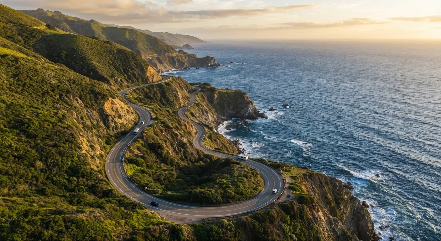
Why the PCH Deserves Its Legendary Status
Few drives on Earth match the Pacific Coast Highway for sheer, sustained drama. California's Highway 1 — the backbone of any PCH road trip — threads along clifftops, dips into redwood canyons, and rolls through sleepy fishing towns for roughly 650 miles between Southern California and the San Francisco Bay Area. It isn't just scenery. It's a full sensory experience: salt air through the windows, hawk-eye views of breaking surf, and the feeling that you've earned every mile.
For US travelers, it also happens to be remarkably accessible. No passport required, road signs are in English, and the infrastructure — fuel, food, lodging — is solid enough to support first-time road trippers and seasoned adventurers alike. If you're building your trip from the ground up, the core phases of trip planning are worth reviewing before you start booking.
650 mi
Approximate PCH length, San Diego to Leggett
Highway 1 runs the length of coastal California, though most travelers focus on the San Francisco–Los Angeles segment of roughly 400 miles.
~90 mi
Fuel-sparse Big Sur stretch
There are very few gas stations between Carmel and San Simeon, making pre-trip fueling essential for any PCH driver.
576 ft
Height of Morro Rock, a volcanic landmark
Morro Rock in Morro Bay is one of nine ancient volcanic peaks known as the Nine Sisters that dot California's central coast.
Choosing Your Direction and Route Scope
Most travelers drive the PCH as part of a point-to-point itinerary — typically San Francisco to Los Angeles or vice versa. Here's a useful insider trick: driving south to north (Los Angeles toward San Francisco) positions your car on the oceanside lane on the famously narrow Big Sur stretch, giving passengers and the driver unobstructed ocean views at every curve.
That said, many people only tackle a portion of the route. The Big Sur segment alone — roughly Carmel-by-the-Sea to San Simeon — is worth a dedicated two-day side trip. Others fly into LA, drive north for a week, then fly home from San Francisco (or Oakland). There's no single right answer; your available days and budget will shape the scope. The end-to-end planning resource can help you map out budgeting and itinerary structure once you've settled on a route length.
Build in at least one unscheduled day for every three days of driving on the PCH. The best moments — a hidden beach trail, a roadside farm stand — happen when you're not racing to the next pin.
Rigid itineraries are the enemy of coastal road trips, where weather, wildlife sightings, and road closures regularly rewrite your day.
Arrive at Big Sur state park trailheads before 9 a.m. on any weekend. Parking lots at McWay Falls and Pfeiffer Beach reach capacity by mid-morning during spring and summer.
Early arrival is the single most effective way to avoid parking fees, crowds, and the frustration of turning back from a must-see stop.
Key Stops You Shouldn't Miss
The PCH isn't a drive you blaze through — it's a series of places worth slowing down for. Here are standout stops organized north to south:
- Point Reyes National Seashore — Wild, windswept, and often overlooked. Elk herds, lighthouse hikes, and dramatic headlands await just north of San Francisco.
- Santa Cruz — A lively university town with a classic boardwalk, surf culture, and excellent seafood on the wharf.
- Big Sur — The crown jewel. Bixby Creek Bridge, McWay Falls, Pfeiffer Beach, and Andrew Molera State Park are all within a short stretch of Highway 1.
- San Simeon / Hearst Castle — The hilltop estate built by newspaper magnate William Randolph Hearst offers tours and a peek into Gilded Age extravagance.
- Morro Bay — A charming harbor town anchored by a 576-foot volcanic rock. Great for kayaking and fresh clam chowder.
- Santa Barbara — Spanish Colonial architecture, a gorgeous beach promenade, and a thriving local food scene make this an easy overnight stop.
- Malibu and the Santa Monica Pier — The southern bookend of the classic PCH experience, with celebrity-adjacent beaches and a buzzy, walkable pier.
Best Time to Drive the PCH
Late spring (May–June) and early fall (September–October) are widely considered the ideal windows. Weather is mild along most of the coast, summer crowds haven't yet peaked (or have just thinned), and wildflowers can still be found blooming in the hills above Big Sur. July and August bring the heaviest tourist traffic, packed campgrounds, and elevated lodging prices — especially around Big Sur and Santa Barbara.
Winter driving is possible and can be strikingly beautiful — moody fog, emptier roads, whale migration off the coast — but Highway 1 through Big Sur is genuinely vulnerable to rain-triggered landslides and road closures between December and March. Always check Caltrans road conditions (caltrans.ca.gov) before you depart, and have a backup inland route in mind.
Landslides Can Close Highway 1 Without Warning
Big Sur's geology makes it one of the most landslide-prone corridors in the US. Heavy rainfall between December and March can — and regularly does — close sections of Highway 1 for days, weeks, or even months. Always check Caltrans road conditions at caltrans.ca.gov before departure and have an inland alternate (US-101) mapped and ready. Do not assume a route is open because it was open last week.
Driving Conditions and Road Safety
The PCH is not a highway in the freeway sense. Through Big Sur especially, it's a two-lane coastal road with sheer drops, limited guardrails, sharp switchbacks, and stretches where passing an RV in the opposite lane requires steady nerves. Speed limits typically run 35–55 mph through the most dramatic sections — follow them.
A few practical realities every driver should know:
- Cell service is spotty in Big Sur. Download offline maps (Google Maps or Maps.me both allow this) before you reach Carmel.
- Fuel up early. Gas stations are sparse between Carmel and San Simeon — a stretch of roughly 90 miles.
- RVs and large vehicles face size restrictions on some sections. Check vehicle advisories if you're renting a large camper.
- Pull-outs are plentiful — use them if traffic builds behind you. Locals appreciate it.
Before you leave home, run through a pre-trip vehicle inspection — brakes, tires, fluids, and emergency kit included. A breakdown on a remote PCH cliff is a very different situation than one near a city.
Lodging Strategy Along the Route
Accommodations range from luxury cliffside inns to state park campgrounds, and the gap in availability can be dramatic depending on the segment. Big Sur is the single biggest challenge: the combination of limited lodging, high demand, and occasional road closures means booking 3–6 months in advance is advisable for summer visits. State park campsites in Pfeiffer Big Sur and Kirk Creek can be reserved through ReserveCalifornia (reservecalifornia.com) — these fill up fast.
In more accessible towns like Santa Cruz, Morro Bay, and Santa Barbara, last-minute availability is more realistic outside peak summer weekends. If flexibility matters to you, consider building your itinerary around the hard-to-book segment first (Big Sur) and leaving the urban bookends more open.
Reserve Big Sur Campsites First, Then Build Around Them
On ReserveCalifornia, Big Sur campsite reservations open six months in advance to the day — and popular spots like Pfeiffer Big Sur often sell out within minutes of opening. Set a calendar reminder, log in exactly at midnight Pacific time on your target date, and have backup dates ready. Once your camping anchors are locked in, plan the rest of your itinerary around them.
Packing, Prep, and Final Logistics
A successful PCH road trip is mostly about not being caught off guard. Pack layers regardless of season — coastal microclimates mean it can be foggy and 58°F at the beach while the inland hills bake at 85°F. Sunscreen, a reusable water bottle, and a good pair of walking shoes are non-negotiables for trail access at state parks.
Budget realistically. Fuel costs along California's coast tend to run higher than the national average. Parking at popular spots like McWay Falls requires a day-use fee and fills by mid-morning on weekends — arrive early or use the Reserv-A-Spot system where available. For a deeper dive into road trip logistics from scratch, including vehicle prep and lodging strategy, we've got you covered. And if the PCH leaves you hungry for more coastal adventure, check out our roundup of underrated US road trip routes for inspiration beyond the obvious.
Travel conditions, road closures, visa requirements, and entry rules can change. Always verify current conditions with official government and transportation sources — including Caltrans and the National Park Service — before your trip.
The content on this site is for informational purposes only and is not a substitute for professional advice. Always consult a qualified professional for guidance specific to your situation.